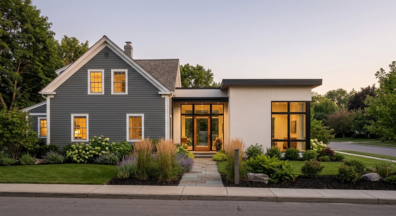
Two Los Altos Hills properties can look similar on paper and still sell for very different prices. If you’ve wondered why, you’re not alone. In hillside markets like this, what you can actually build and the quality of the view often matter more than raw acreage. In this guide, you’ll learn how local rules convert acres and slope into a buildable envelope, how view premiums work, and the practical steps to value a parcel with confidence. Let’s dive in.
What drives land value here
Los Altos Hills uses low-density zoning and hillside protections that keep parcels large and building sites carefully managed. Much of the Town observes a one-acre minimum norm and design controls that preserve a rural feel, which makes large, flat building areas scarce and valuable. You can see this policy direction in the Town’s adopted Housing Element that references one-acre minimum zoning and hillside character goals. Review the Town’s background policies in the adopted Housing Element to understand the context behind today’s development rules (Town Housing Element).
Buildable envelope vs. gross acres
The Town translates lot size and average slope into a Lot Unit Factor (LUF), then uses formulas to compute your Maximum Floor Area (MFA) and Maximum Development Area (MDA). These numbers define the buildable envelope, and buyers tend to pay for that envelope more than for raw acreage. The formulas sit in the Municipal Code and adjust with slope, which is why two parcels with the same acreage can have very different permitted square footage (MFA/MDA formulas in the code).
Siting and view protections
Separate siting rules also influence value. During design review, the Town applies visual and ridgeline protections, along with creek setbacks, that shape where a home can sit and how tall or prominent it can appear on the hillside. These rules help preserve visible vistas and the natural character of slopes, and they can also affect specific view corridors for you and your neighbors (siting and visual standards).
MFA and MDA in plain English
How the formulas work
Here is the simple version. The Town calculates LUF based on net lot area and average slope, then:
- For gentle slopes (S at or below 10 percent): MFA = LUF × 6,000 square feet.
- For moderate slopes (between 10 percent and 30 percent): the per-LUF factor steps down linearly.
- For steep slopes (at or above 30 percent): MFA = LUF × 5,000 square feet.
- Analogous rules apply to MDA, such as MDA = LUF × 15,000 square feet on low slopes, plus minimum floors for constrained sites.
You can confirm the exact factors and any minimums in the Municipal Code and by using the Town’s fillable worksheet to compute a parcel’s LUF, MFA, and MDA (MFA/MDA code reference; Town worksheet page).
Why it affects price
Because MFA and MDA define how much you can build, they act like a common yardstick across very different parcels. A practical way to compare lots is to estimate Price per Permitted Square Foot: sale price divided by allowed MFA. For illustration, if the median sale in town is about $5.1 million and a fairly flat one-acre lot often permits roughly 6,000 square feet, that implies around $850 per permitted square foot. If a steeper parcel allowed only 5,000 square feet, the same $5.1 million would pencil to about $1,020 per permitted square foot. The takeaway is simple: slope and permitted envelope drive what buyers are willing to pay.
Topography, shape, and privacy
Slopes, circles, and conservation areas
In Los Altos Hills, a large, flat building circle can be worth more than extra raw acres you cannot use. The code allows you to recalculate LUF and MFA off gentler areas in some cases if you place steeper portions under a conservation easement. That can help concentrate development in the most buildable spot, protect the hillside, and sometimes preserve a view corridor, but it also formalizes permanent limits on future development (MFA/MDA code reference).
Access, grading, and real costs
Long driveways, retaining walls, drainage control, and slope stabilization add real dollars to any build. Most hillside projects require geotechnical studies and careful grading design, and the Town emphasizes minimizing excessive grading while documenting site stability. These engineering and permitting realities affect buyer appetite and the effective land premium for a tricky lot (Town fast-track guidance).
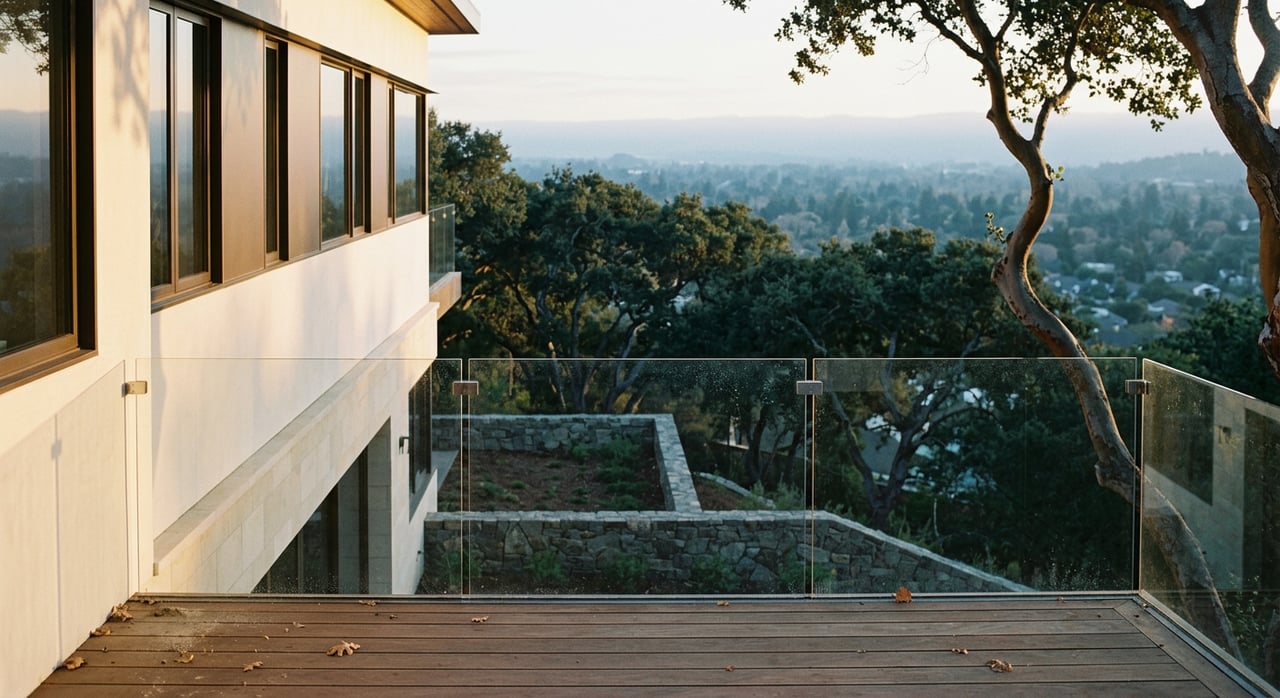
Views: how to think about premiums
What the studies show
View premiums are real, but they are not one-size-fits-all. Academic hedonic research finds that water and broad bay views typically produce the largest premiums, while mountain, valley, or urban views produce smaller but still meaningful bumps. The size of the premium also depends on the scope of the view and whether it is unobstructed or partial. Treat the literature as directional ranges and rely on local comps for the final adjustment (evidence from hedonic studies).
Apply it locally
For Los Altos Hills, start by classifying the view clearly: wide bay, partial bay, valley, mountain, or city lights. Then compare to recent sales with the same classification and similar siting. As a rule of thumb, good valley or bay views often add a low double-digit percentage, while wide, unobstructed bay views can command more. The exact number is case-by-case and will reflect the view’s breadth, distance, and permanence.
Protecting your view
California law does not provide a general right to a view across your neighbor’s land. Lasting protection usually comes from a recorded view easement or from municipal siting limits that indirectly preserve sightlines. If no easement exists, assume a neighbor can build within the planning rules even if it changes your current outlook. When a view drives your value, look for recorded easements or include contingencies to verify what is feasible next door (legal overview on view rights; Town siting rules).
Infrastructure, hazards, and hidden modifiers
Sewer and water
Sewer service in Los Altos Hills is provided through arrangements with the West Bay Sanitary District. Some parcels can connect directly, while others may need on-site wastewater solutions if allowed. Water can be a public meter or a private well, and that difference can affect insurance, lending, and operating costs. Verify sewer and water early in diligence and with Town staff or the worksheet process (West Bay Sanitary background; Town worksheet page).
Wildfire classification and insurance
Cal Fire updates and local map adoptions have changed some parcel hazard designations to Very High Fire Hazard Severity Zones. That can mean additional defensible space, sprinkler, access, and egress requirements, along with insurance implications. Always check your current classification and budget for any site work tied to fire safety (Town wildfire hazard map page).
Geotechnical and grading budgets
Hillside homes often need geotechnical reports, grading plans, and possibly deep foundations or retaining walls. The Town’s permitting guidance highlights the need to minimize grading and document stability, which translates to time and money in your pro forma. Build these costs into your valuation up front to avoid surprises (Town fast-track guidance).
A practical valuation framework
Use this simple, finance-first sequence to compare parcels:
Get the numbers that matter. Request the Town’s LUF, MFA, and MDA for the parcel using the official worksheet. Confirm any minimum MFA/MDA floors that apply (Town worksheet page).
Normalize by utility. Convert asking prices and comps to Price per Permitted Square Foot (price divided by allowed MFA). Use this as a screening metric to compare lots of different sizes and slopes.
Adjust for view quality. Classify the view, then look at recent Los Altos Hills comps with similar views. Use academic ranges as a reasonableness check, not a substitute for local data (hedonic evidence).
Layer in siting and privacy. A large, flat building circle, low visual prominence, and strong privacy often justify a premium compared to steep or highly constrained sites.
Account for infrastructure and hazards. Sewer or OWTS needs, water source, fire designation, and access upgrades can change net value meaningfully (West Bay Sanitary background; wildfire hazard map).
Check legal protections. Search title for view, access, and conservation easements. If your view drives value, consider story poles, an appraisal with a distinct view line item, and negotiating for an easement where feasible (siting and view regulations).
Buyer and investor due-diligence checklist
Use this step-by-step list when you’re serious about a parcel:
- Request the Town’s MFA/MDA worksheet and LUF calculation for the specific parcel. Use it to compute permitted MFA and MDA (worksheet page).
- Pull recent local comps for the same neighborhood and view classification. If comps are sparse, expand the time window and weight recent sales higher.
- Commission a geotechnical report, a grading feasibility memo, and a preliminary site plan showing 160-foot building circle(s). Cross-check these with the MFA worksheet assumptions (fast-track guide).
- Confirm sewer and water service early. Identify whether a public sewer is available or an on-site wastewater system will be required, and verify water meter availability and capacity (West Bay Sanitary background).
- Check current fire hazard classification and egress options, and budget for defensible-space or access improvements as required (wildfire hazard map).
- Run a title search for view or access easements, conservation easements, and any tree protections. If no view easement is recorded, assume neighboring development could affect your outlook subject to Town siting rules (siting and visual standards).
- If the view drives value, consider contract contingencies for story poles, an appraisal that isolates a “view” line item, and potential negotiations for a view corridor agreement.
- Convert asking and comp prices into a Price per Permitted Square Foot metric, then apply your view and siting adjustments to estimate fair value (worksheet page).
Work with a finance-first advisor
Understanding LUF, MFA/MDA, and view premiums lets you price Los Altos Hills land with clarity. If you want a data-driven approach that blends corporate-finance discipline with local insight, partner with a trusted advisor who lives this market every day. For a clear valuation, tailored comps, and hands-on guidance through due diligence, connect with Shabber Jaffer.
FAQs
What are MFA and MDA in Los Altos Hills?
- MFA is the Maximum Floor Area you may build, and MDA is the Maximum Development Area that governs overall site coverage. Both are calculated from lot size and slope using Town formulas.
How do views impact home prices in Los Altos Hills?
- Views often increase prices, but premiums vary by view type, scope, and obstructions. Broad bay or water views tend to command higher premiums than partial valley or mountain views.
Does California law protect my view in Los Altos Hills?
- There is no general right to a view. Long-term protection usually requires a recorded easement or results from Town siting rules. Without an easement, a neighbor may build subject to planning limits.
How can I compare two hillside lots fairly?
- Normalize prices by utility: divide price by the parcel’s allowed MFA to get Price per Permitted Square Foot, then adjust for view quality, privacy, access, and infrastructure needs.
What infrastructure factors can change land value?
- Sewer connectivity, on-site wastewater requirements, water source, wildfire designation, and roadway access can add costs or constraints that affect marketability and price.
What due diligence should I do before I make an offer?
- Obtain the Town’s MFA/MDA worksheet, verify sewer and water, commission geotechnical and grading studies, review fire hazard designation, and search title for easements or restrictions.